For the purpose of producing datasets for regional scale global change research and application, the NCEP/NCAR Reanalysis for the period 1948-2005 was dynamically downscaled to hourly, 10km resolution over California using the Regional Spectral Model. In order to maintain the large-scale features of the global reanalysis, the Scale Selective Bias Correction has been appied to minimize the large scale errors which develop within the regional domain.
The paper describing the detail of Scale Selective Bias Correction is
Kanamaru, H. and M. Kanamitsu, 2007: Scale-Selective Bias Correction in a Downscaling of Global Analysis using a Regional Model. Monthly Weather Review, 135 (2), 334–350.
The two parts paper describing the details of the CaRD10 are
- Kanamitsu, M. and H. Kanamaru, 2007: 57-Year California Reanalysis Downscaling at 10km (CaRD10) Part 1. System Detail and Validation with Observations. J. Climate, 20, 5527-5552. card10_part1.pdf http://dx.doi.org/10.1175/2007JCLI1482.1
- Kanamaru, H. and M. Kanamitsu, 2007: 57-Year California Reanalysis Downscaling at 10km (CaRD10) Part 2. Comparison with North American Regional Reanalysis. J. of Climate, 20, 5553-5571.card10_part2.pdf http://dx.doi.org/10.1175/2007JCLI1522.1
CaRD10 data are now available at http://cec.sdsc.edu.
CaRD10 covers the area: latitude (29.5N to 45.7N) and longitude (128.2W to 111.6W) with 161x200 grid cells (about 10km horizontal resolution).
The data is in GRIB format. Take a look at this page for softwares to read GRIB files. The data server has all control and index files that are associated with GRIB files, so you do not need to create them. However, you may need to edit the path in "dset" and "index" of a control file to your local directories. The web site currently does not have detailed descriptions of each file. Please do not hesitate to contact me (Hideki Kanamaru; hkanamaru@ucsd.edu) if you have any questions.
This web site may be helpful to understand variable names: http://dss.ucar.edu/datasets/ds090.0/docs/variablelists/all-vars-file
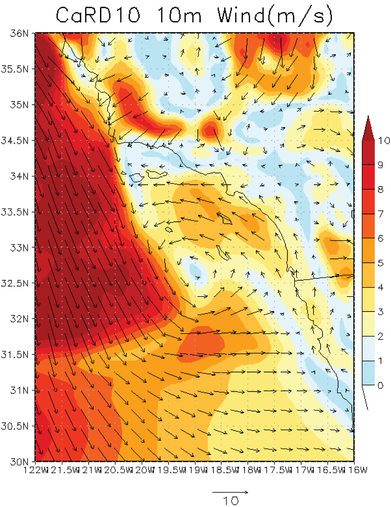
Sample plot: Comparison of a Catalina Eddy event in CaRD10 at 1500UTC on May 22, 1984. Wind arrows are plotted for only one in three grid cells of CaRD10 to avoid crowding. Shades are wind speed (m s-1).
