(written by Masashi Minamide: minamide@psu.edu, 13th Apr 2015)
cf. Minamide, M., & Yoshimura, K. (2014). Orographic Effect on the Precipitation with Typhoon Washi in the Mindanao Island of the Philippines. SOLA, 10, 67–71. doi:10.2151/sola.2014-014
The orographic boundary condition (the surface height) file is created in rsm/src/rmtn .
If you would like to change this boundary condition such as eliminating a mountain, you can conduct by following this process:
How to
1. Edit rsm/src/rmtn/rtersub.F
In this file, there are following statements
do lat = 1,jm2
c.... for n.s. grid
jlat = (lat-1)*im2
do i = 1,im2
grids(i) = oro(i+jlat)
enddo
You can change the surface height of any grid points by replacing the value of grids(i).
2. make in rsm/src/rmtn directory
3. run the simulation
Example
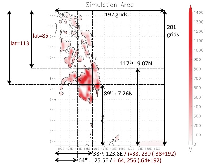
For example, you can eliminate a mountain in the Philippines.
Model Domain:
| Grid (x,y) |
192 * 201 |
| Center point |
125.0E, 7.0N |
Following code can eliminate a mountain and set the surface height as 0m.
do lat = 1,jm2
c.... for n.s. grid
jlat = (lat-1)*im2
do i = 1,im2
if (((lat.ge.85).and.(lat.le.113)).and.(((i.ge.38).and.(i.le.64)).or.((i.ge.230).and.(i.le.256)))) then
grids(i) = 0.0
else
grids(i) = oro(i+jlat)
enddo
Relationship between model grid and variables in rsm/src/rmtn/rtersub.F
The "lat" in rsm/src/rmtn/rtersub.F is aligned from North to South, which is opposite direction from GrADS.
The grids in zonal direction is aligned in the same as GrADS, from West to East.
However, the xth grid is corresponded to both x and x+xmax as "i" in rsm/src/rmtn/rtersub.F , where xmax is the number of grids in zonal direction.

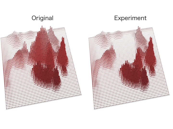
Impact of the alteration
You can see that the mountain in the center of the island is eliminated.
